File:SouthWings Map.jpg
Jump to navigation
Jump to search
No higher resolution available.
SouthWings_Map.jpg (587 × 474 pixels, file size: 92 KB, MIME type: image/jpeg)
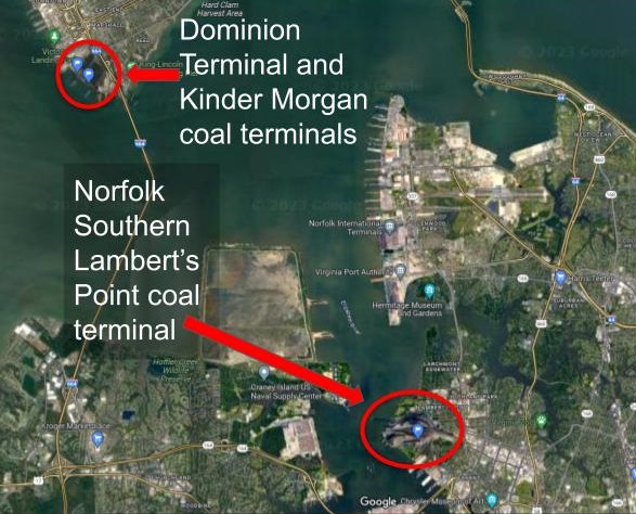
Map depicting the coal terminals in the Norfolk and Newport News area from a Google Maps screenshot.
File history
Click on a date/time to view the file as it appeared at that time.
| Date/Time | Thumbnail | Dimensions | User | Comment | |
|---|---|---|---|---|---|
| current | 01:47, 17 April 2025 | | 587 × 474 (92 KB) | Voicesinthedust access (talk | contribs) |
You cannot overwrite this file.
File usage
There are no pages that use this file.